A strong legal footing
The program materials cite Government Regulation 22/2021 on forest-area arrangement and ATR Regulation 18/2019 on customary land.



Collaboration to fortify custom as nature’s shield.

Get to know who lives near you. Threatened wildlife may be closer than you think.
Tesso Nilo, Kampar kenegerian, Siabu protection forest, and coastal peat tell the same pressure story: concessions, farms, and customary claims on one map.
 Riau
Riau Riau
Riau RiauRiau
A cinematic flight over Tesso Nilo: what remains, what's been lost, and who still lives there. Data and sources, woven into one story.
Start the storyA Kampar protected forest that entered Green Policing reporting: the map overlay is context, not a verdict.
Start the storyImbo Putui and other Kampar customary forests: decrees exist; official polygons are not always open.
Start the storyKampar kenegerian, Talang Mamak, Sakai, coastal peat, and Tesso Nilo share one shrinking landscape. We compile satellite data and public registries into a Riau map anyone can check, so people can see, not accuse.
United to Guard Bumi Lancang Kuning
A joint effort of the Riau Malay Customary Institution (LAMR), the land agency (BPN), Polda Riau, and environmental observers. Three programs and three collaboration principles: protect forests, prevent land-and-forest fires, and tidy customary land legality.
This describes a collaboration program. It is not an official Polri portal or a case channel. Green Policing remains a data observatory; right of reply is through /lapor.
The program materials cite Government Regulation 22/2021 on forest-area arrangement and ATR Regulation 18/2019 on customary land.
LAMR hosts: Malay custom opens and closes every joint activity.
The focus is concrete output: territory maps, land certificates, and policy declarations.
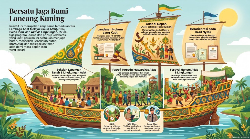
The full picture: three principle sails, three program decks, and the roles of LAMR, BPN, and Polda Riau.
One-day village sessions on customary law, land certification, fraud patterns, and fire prevention.
Output: land-rights literacy and jelutung planting practice
Regular watches at vulnerable points for illegal logging, illegal mining, fires, sacred sites, and strategic-project land.
Output: monthly reports and hotspot handling
A cultural campaign and peace declaration to guard Riau’s nature.
Output: peace declaration and customary maps
Guide to sacred territory and teacher of customary law.
Certificate validity checks and land registration.
Patrol command, law enforcement, and education on land-fraud patterns.
Record damage and monitor hotspots.
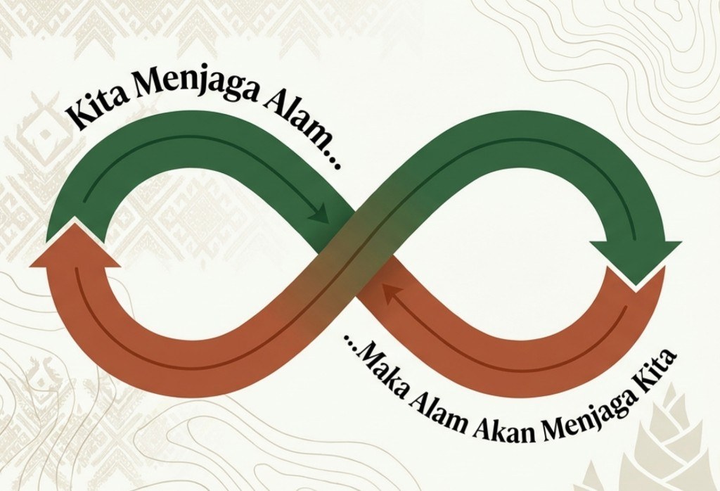
People and forest live in one cycle: caring for living space is caring for ourselves. Green Policing stands inside that loop, not outside it.
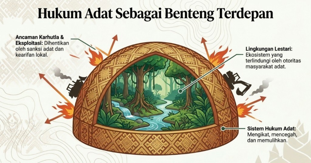
Customary sanctions and local wisdom stop forest-fire and exploitation threats. The system binds, prevents, and restores — so the ecosystem stays under Indigenous authority.
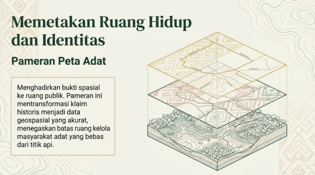
The customary-map exhibition brings spatial evidence into public view: historical claims become geospatial data that affirms community-managed boundaries, free of fire hotspots.
We show official data and satellite imagery side by side, so you can read and compare them yourself.
Anything on screen traces back to its source dataset in at most two clicks.
Our pipeline is open: anyone can re-run it and get the same numbers.
Awareness begins with clear information. Open the map, explore your region, and share what you find.
Open the map